REGIONAL SCENARIOS
THREE PATHWAYS FOR RESILIENCEIn the Raritan River and Bay Communities (RRBC) region, Middlesex County has partnered with the municipalities of Carteret, Woodbridge, Perth Amboy, South Amboy, Sayreville, South River, and Old Bridge, as well as the YMCAs of Middlesex County, to develop a regional action plan to address flood risk and climate change. Input from those who live, work, or visit the region is a critical element to ensure the plan reflects the needs and priorities of the region and has the public’s support to carry forward the plan through implementation. We have developed three distinct regional scenarios for 2070 based on community engagement and ongoing discussions, as well as our analysis of risk and potential resilience tools. These scenarios guided development of the Action Plan released in Fall 2022 The region team is currently working to implement the recommendations of the Action Plan.
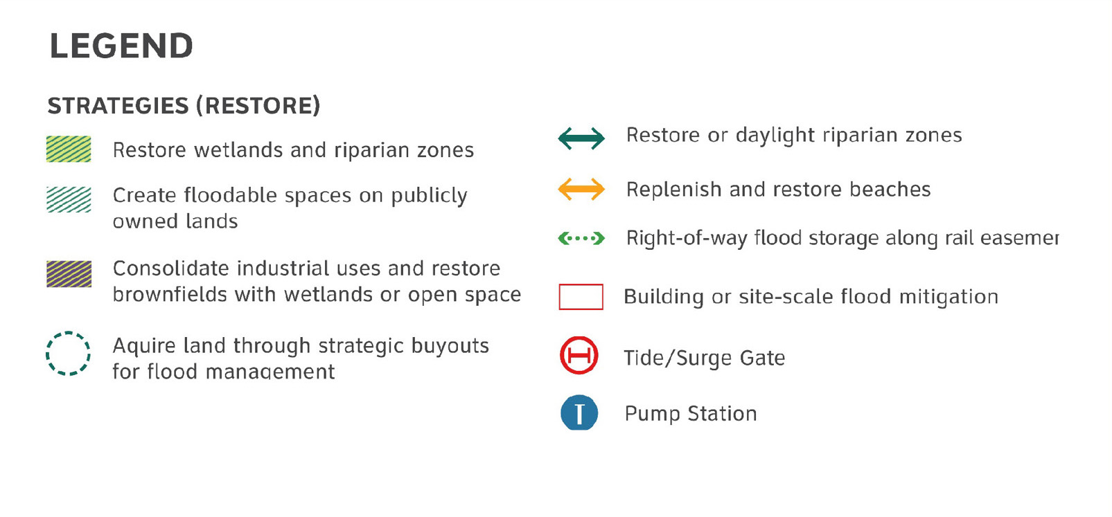
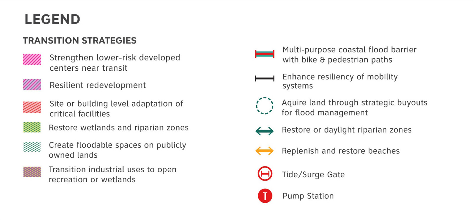
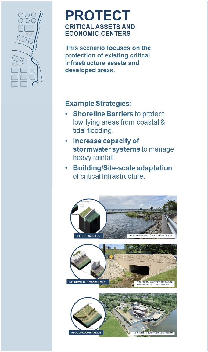
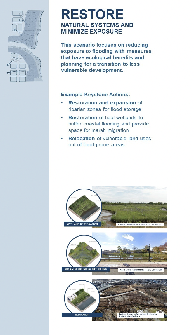
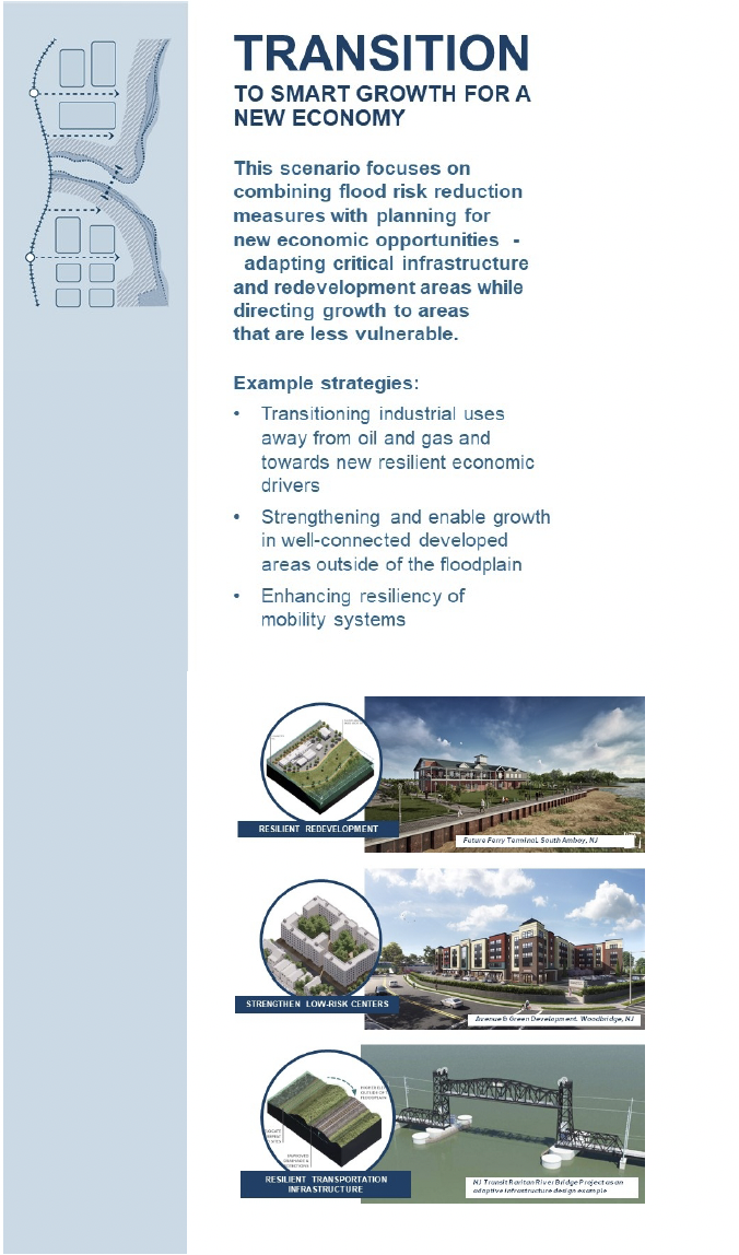
Each scenario has a common theme and is comprised of a range of “Keystone Actions” to address flood risk. The scenarios will be assessed using evaluation criteria to ensure consistency with the project’s vision and objectives. Based on this evaluation we have developed a preliminary preferred scenario “Protect, Restore, and Transition” which combines elements of all three scenarios and includes more resilient development patterns, feasible flood mitigation projects, and transformational open space/ecological improvements. This was discussed at our May Community meeting, see more here.
WATERSHED- BASED APPROACH
Projects, policies and programs are organized into keystone actions by watershed- based sub-geographies to address shared flood risk and plan cross municipal boundaries. Using three overarching scenarios as a framework, we divided the region into study areas and developed specific strategies for each. These study areas are based on watershed boundaries as well as areas with common risk and land use patterns.

SCENARIOS BY FOCUS AREA
Arthur Kill Industrial Waterfront
Raritan Riverfront and Bay
Woodbridge Creek
South River and Washington Canal
Rahway River and Tributaries
Cheesequake, Laurence Harbor and Raritan Bay Waterfront Park
Arthur Kill Industrial Waterfront FOCUS AREA
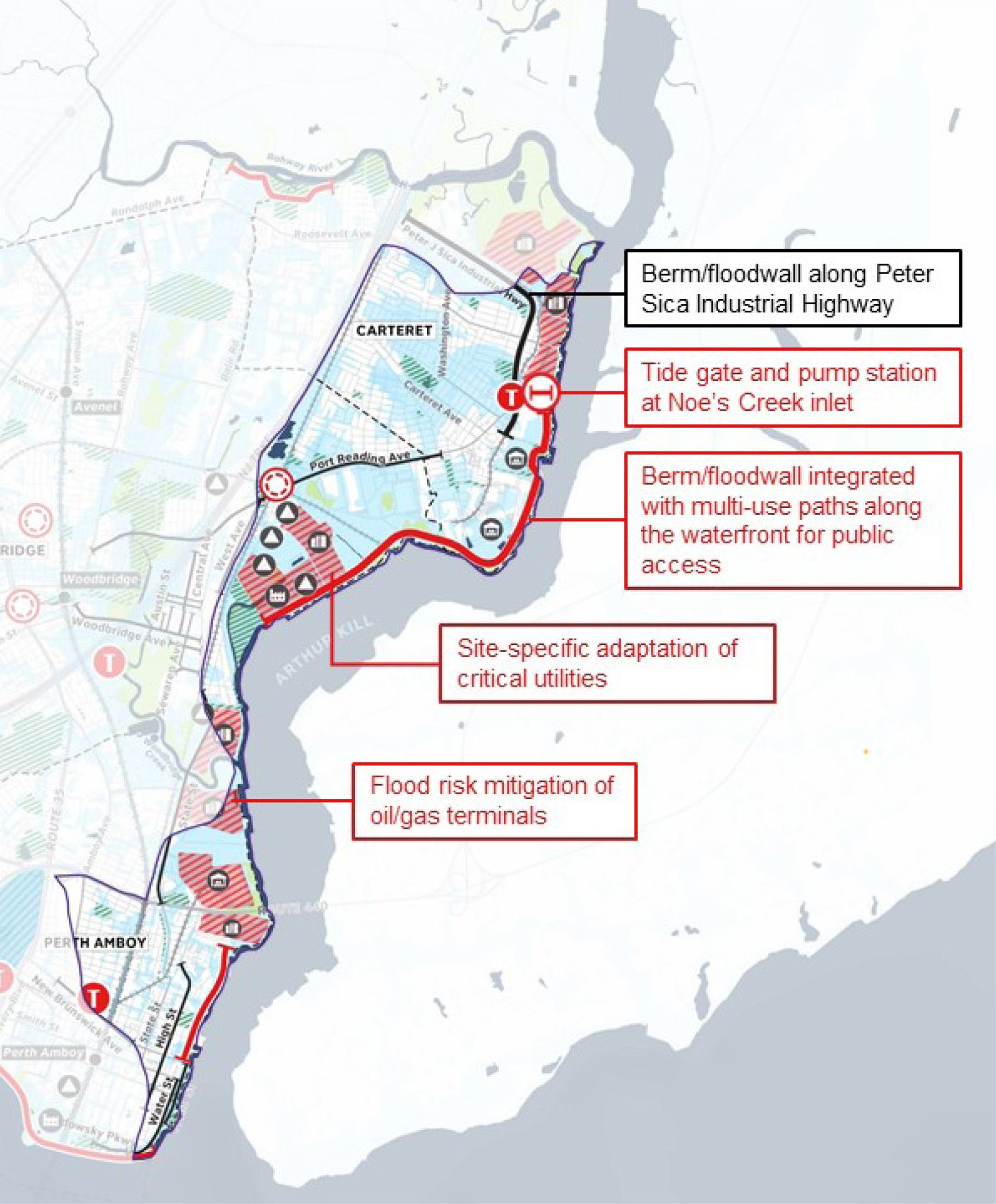
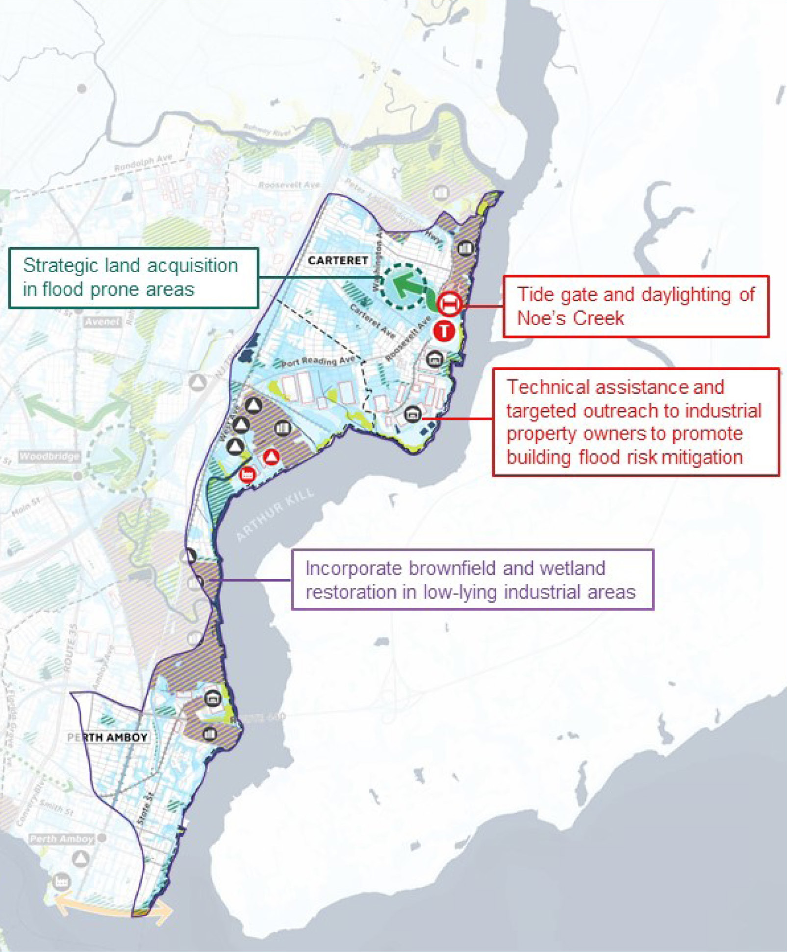
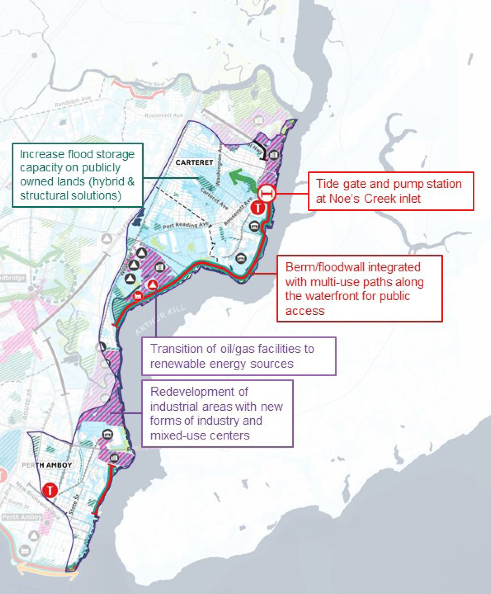
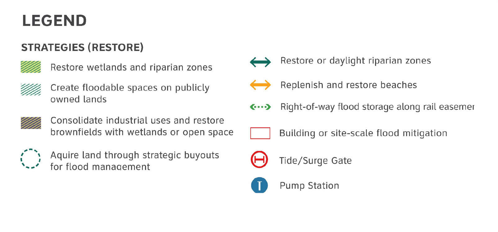
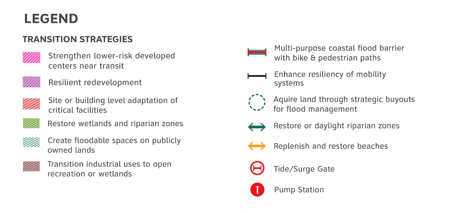
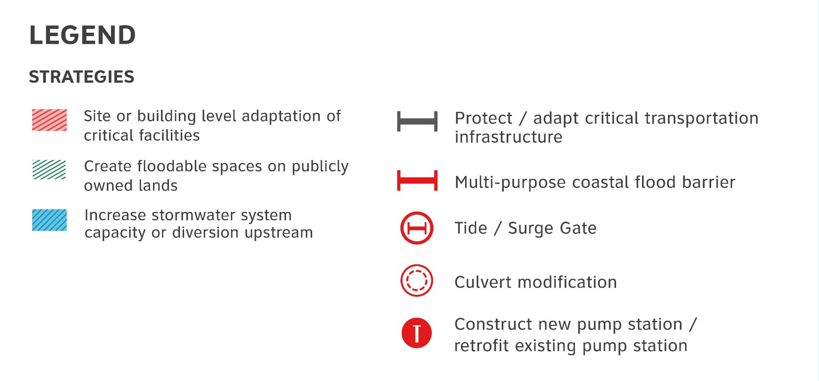
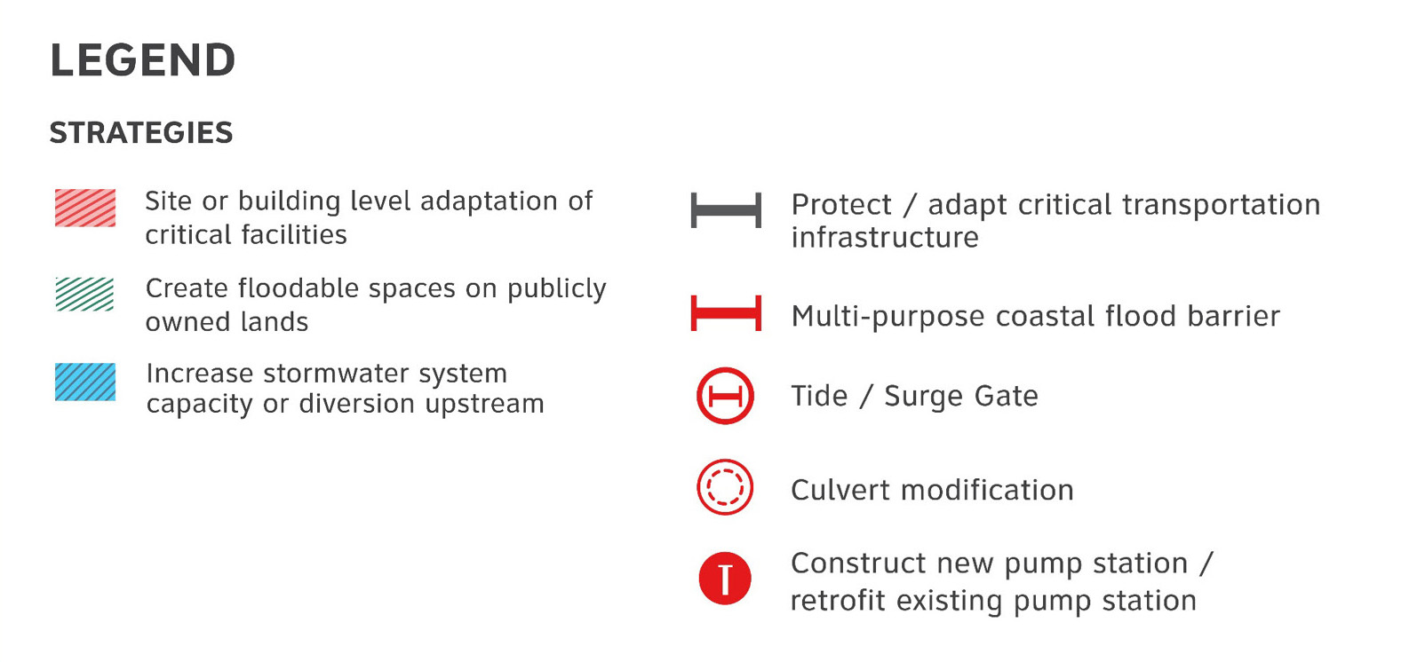
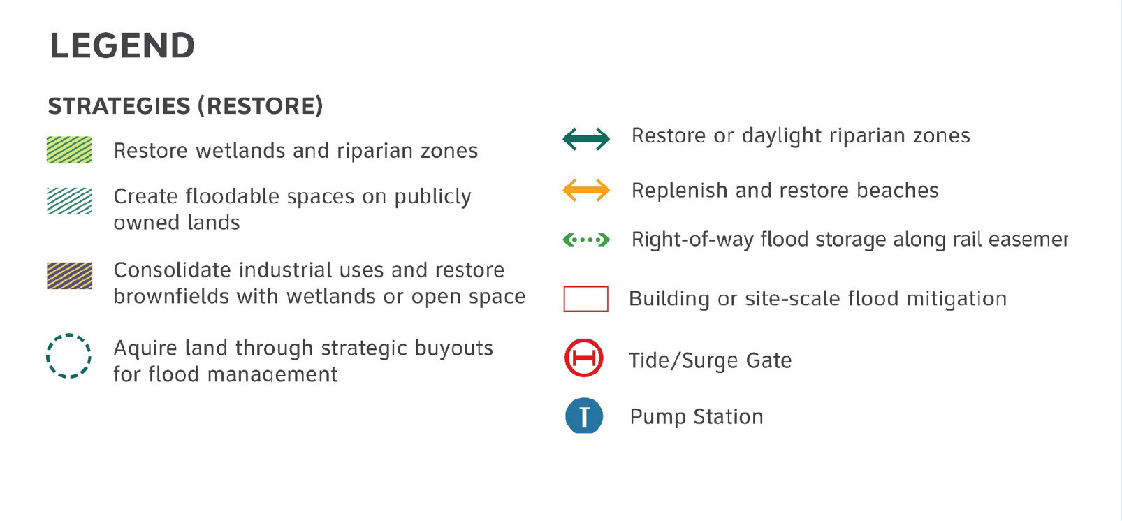
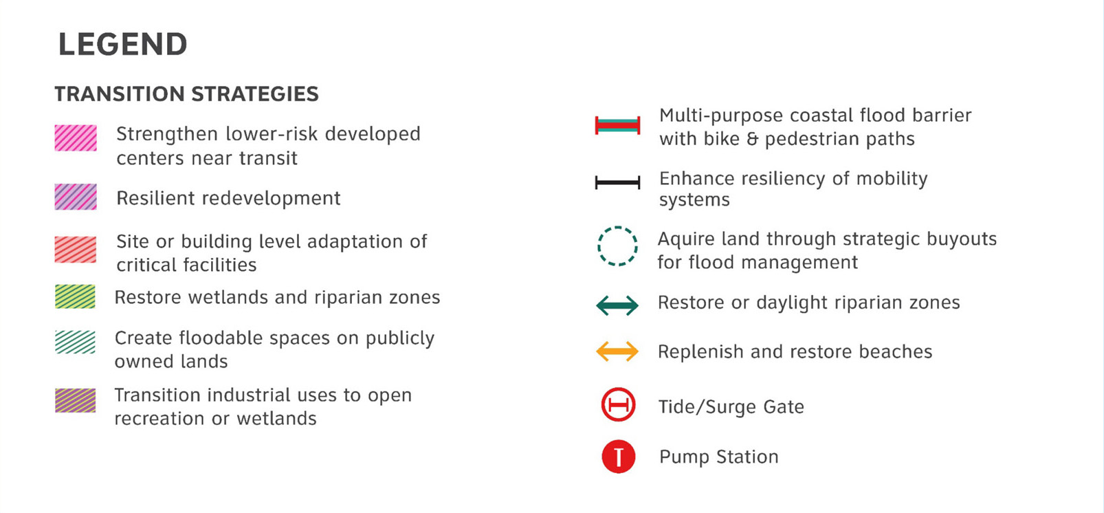
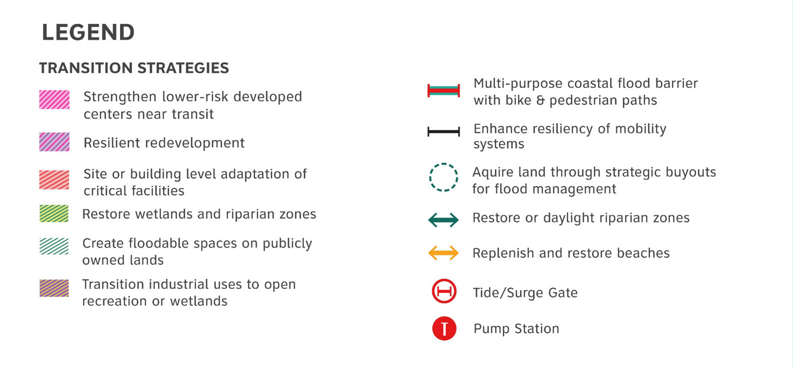
The protect scenario for Arthur Kill Industrial Waterfront includes shoreline barriers and site/building scale adaptation of critical assets, particularly utilities, as well as a tide gate/barrier to prevent flooding via Noe’s Creek in Carteret and interior drainage improvements in Perth Amboy. The restore scenario includes incorporation of wetland restoration and remediation of brownfields around industrial areas, and daylighting of Noe’s Creek to create additional stormwater capacity. The transition scenario transition also proposes a shoreline barrier integrated into new waterfront redevelopment and recreational networks. Resilient redevelopment of industrial sites enables adaption of facilities but also opportunities for new types of industry including renewable energy and logistics, for existing industrial sites.
Woodbridge Creek FOCUS AREA
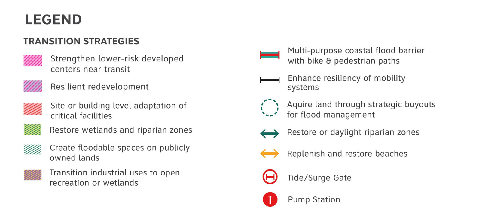
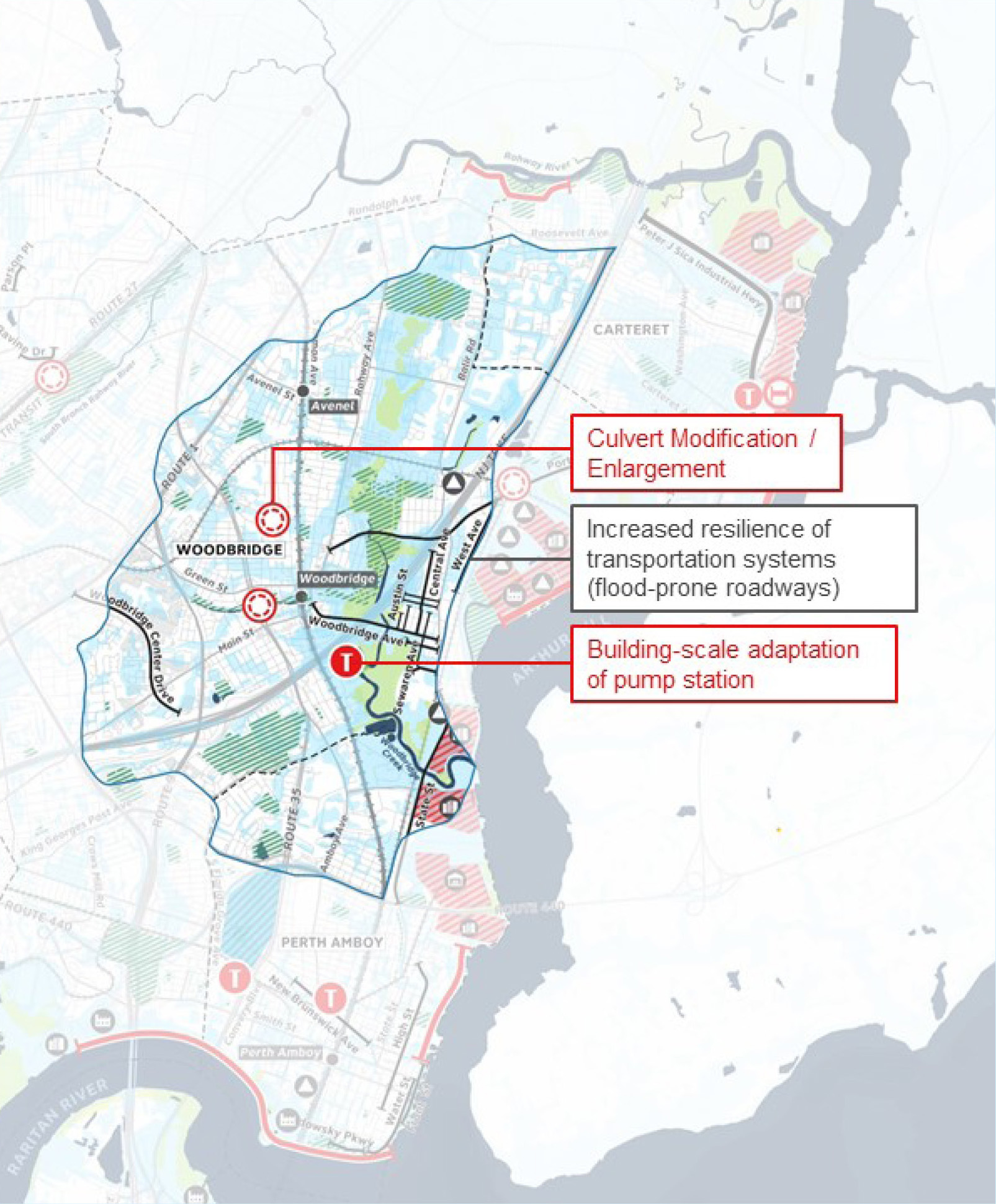
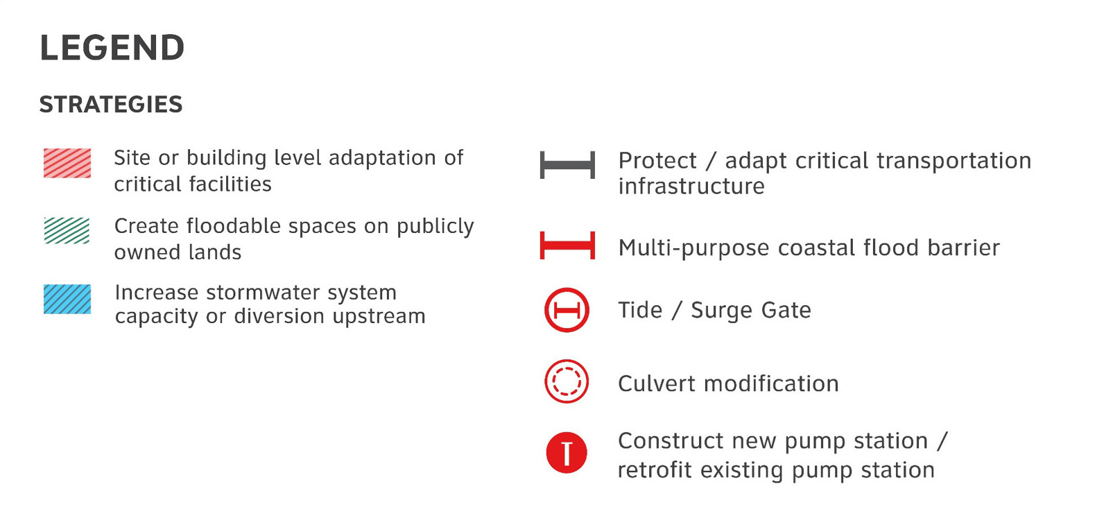
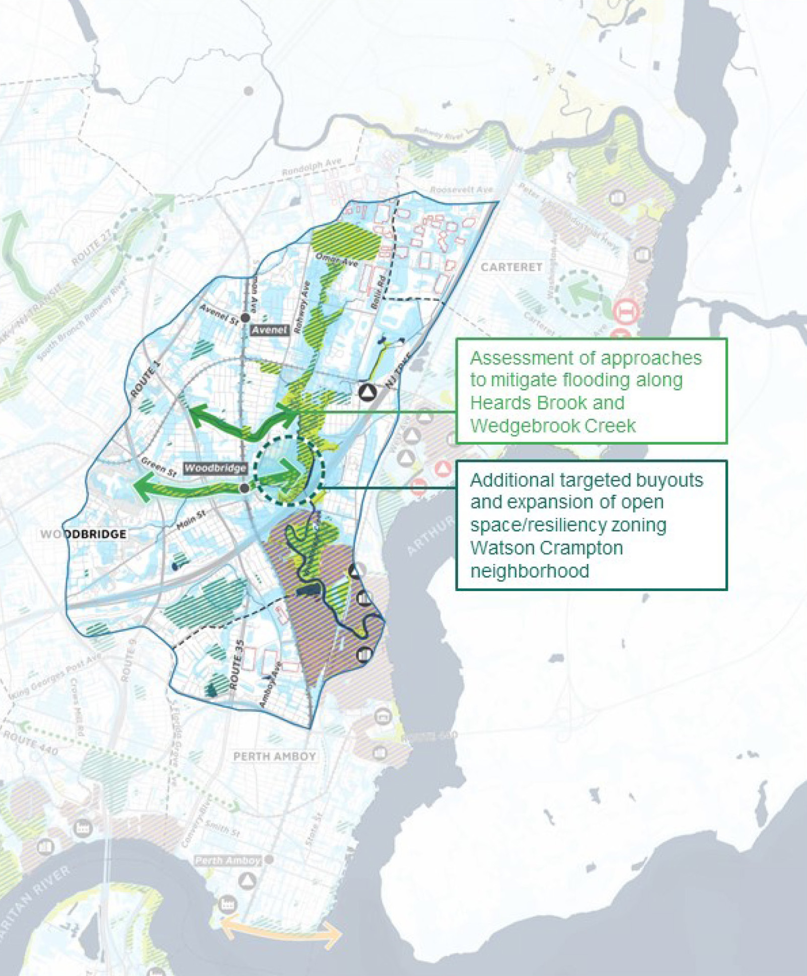
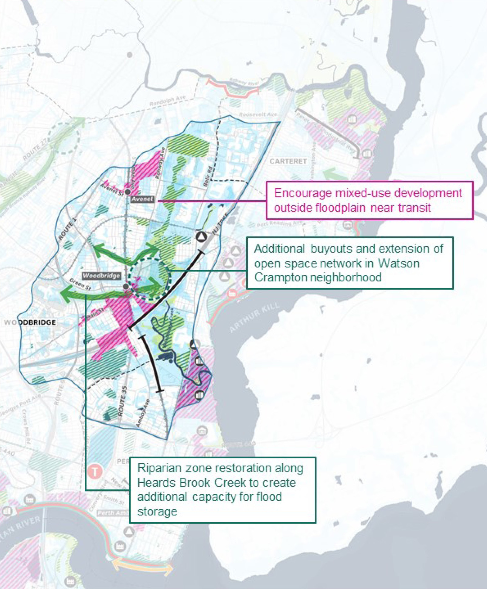
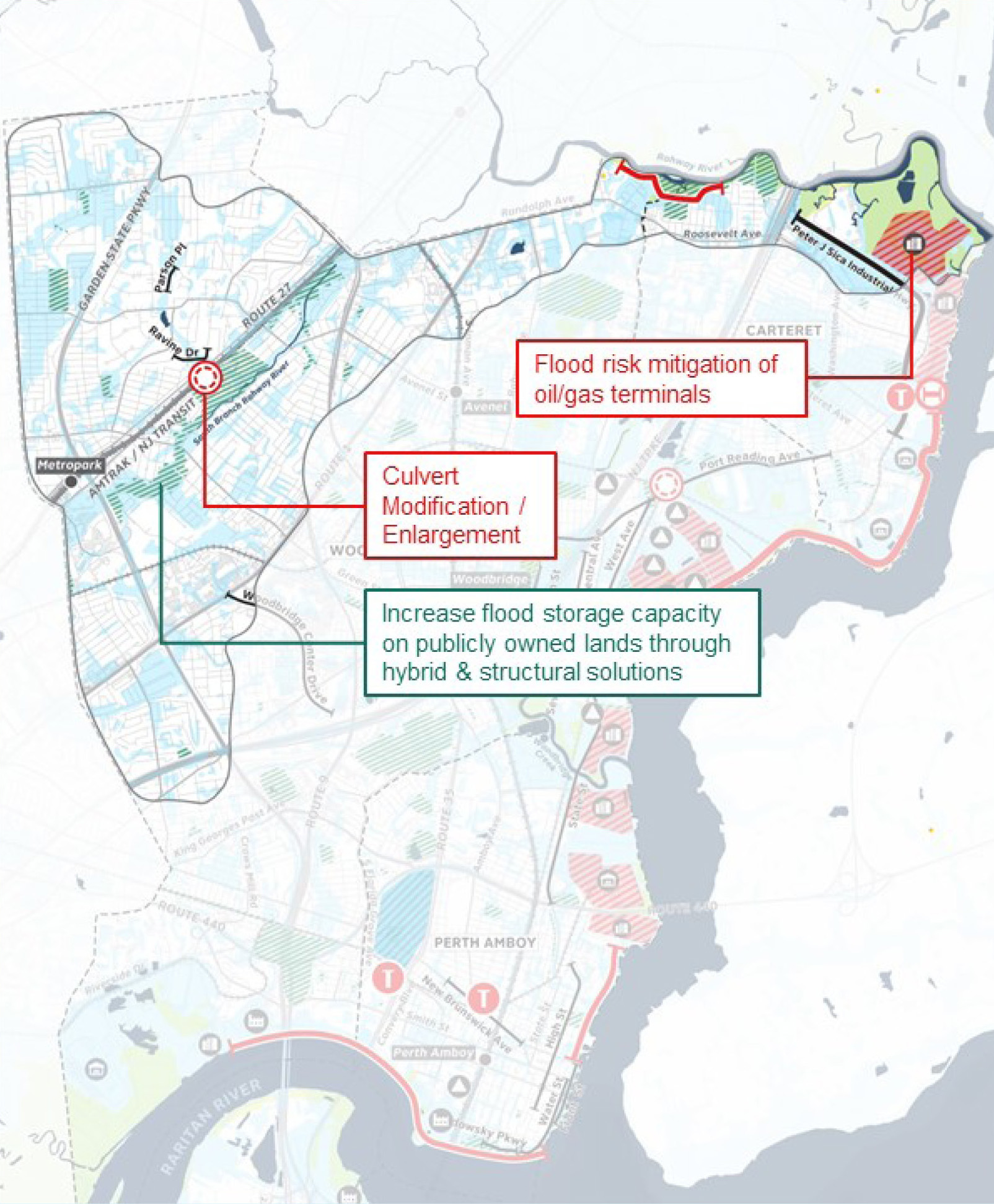
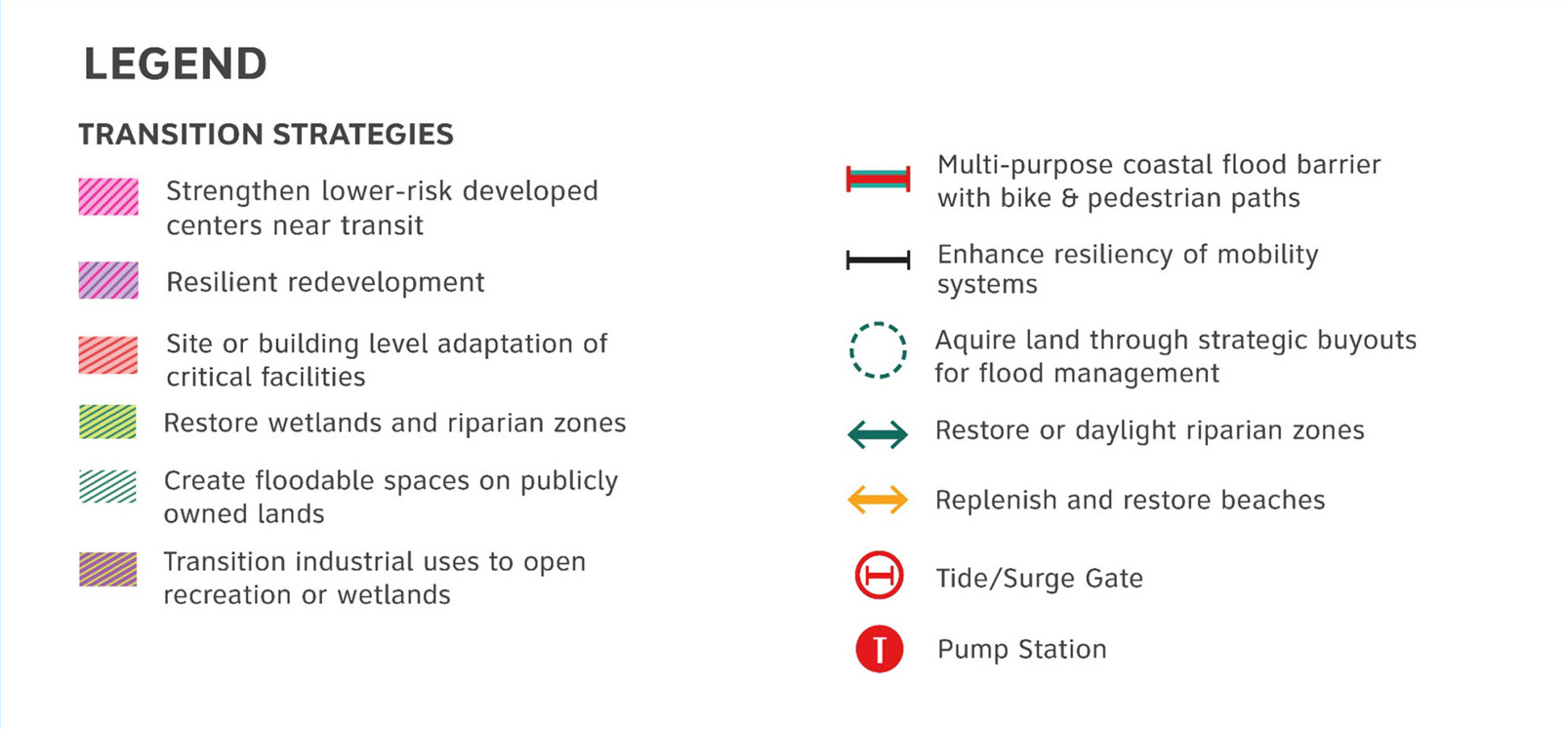
The protect scenario for Woodbridge Creek reduces flood exposure through culvert enlargements to improve conveyance along tributary creeks, improvements to existing infrastructure like the pump station, coupled with measures to increase the flood storage capacity of public lands. The restore scenario includes restoring creeks and tributaries, like Heard’s Brook Creek, to create additional space for stormwater, and riparian zone restoration or expansion through additional targeted buyouts of vulnerable homes adjacent to creeks. The transition scenario also focuses on restoring riparian zones to address stormwater flooding, including additional targeted buyouts, but also by encouraging increased density outside the floodplain and near transit stops to reduce the pressure for development in flood-prone areas.
Rahway River and Tributaries FOCUS AREA
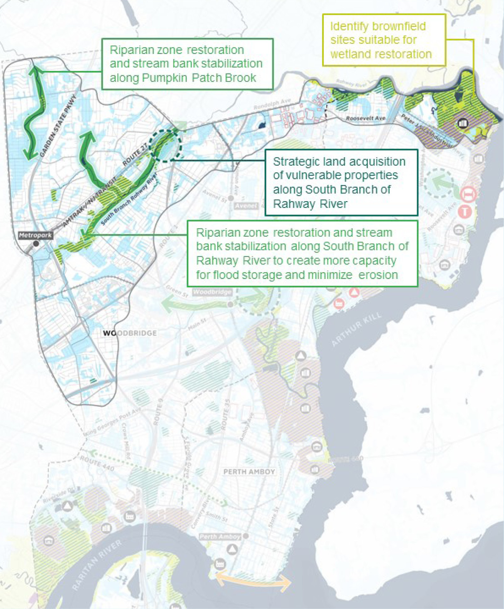
The protect scenario for Rahway River and Tributaries includes shoreline barriers, hardened industrial facilities and roadway elevation near the mouth of the Rahway River as well as culvert enlargements to improve conveyance along tributary creeks. The restore scenario includes focuses on riparian zone and wetland restoration and stream bank stabilization. The transition scenario proposes a similar combination of resilient redevelopment of industrial sites along Rahway River and strengthening areas near transit for mixed-use development and knitting areas together with green networks that mitigate flooding.
RARITAN RIVER AND BAY FOCUS AREA
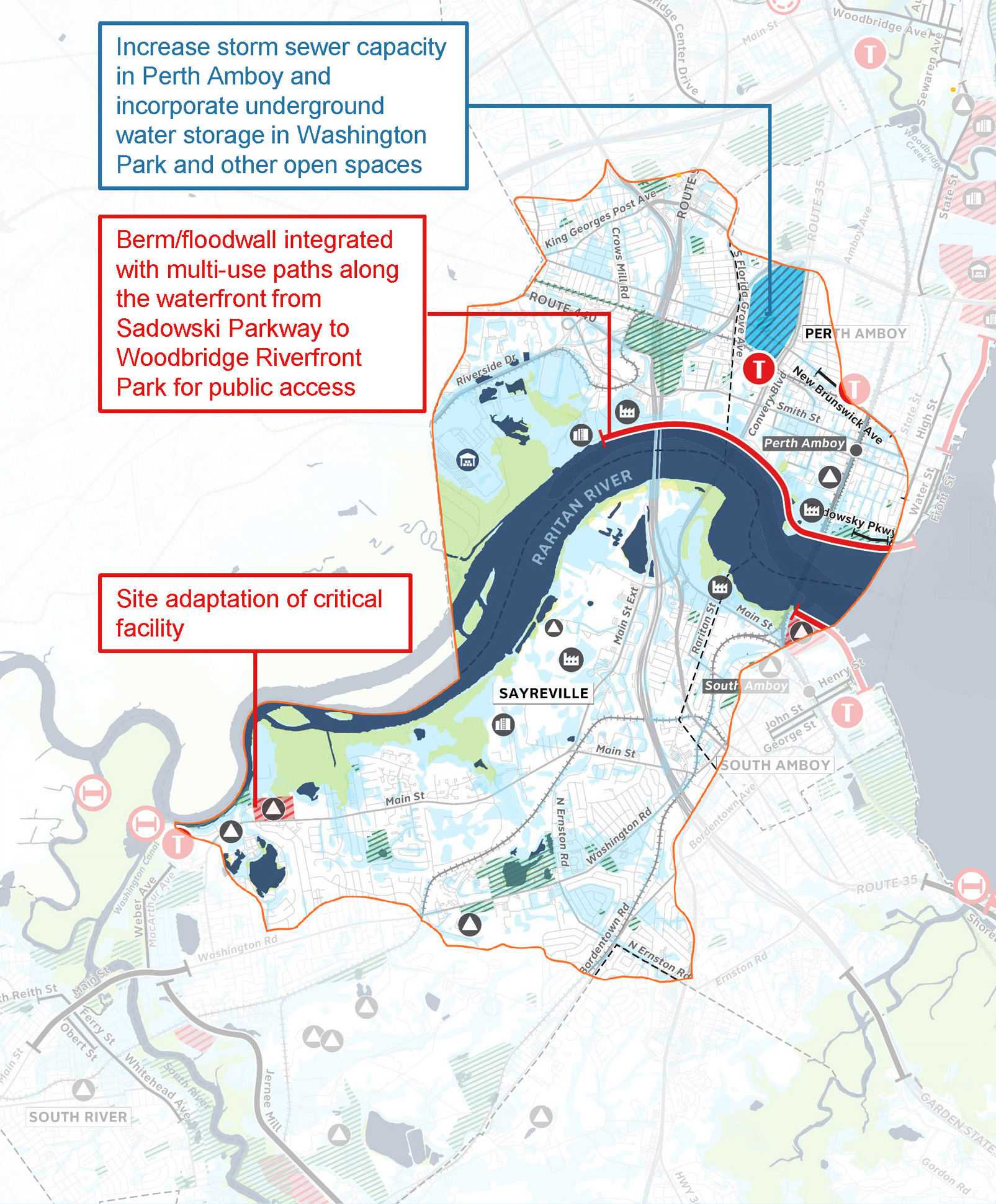
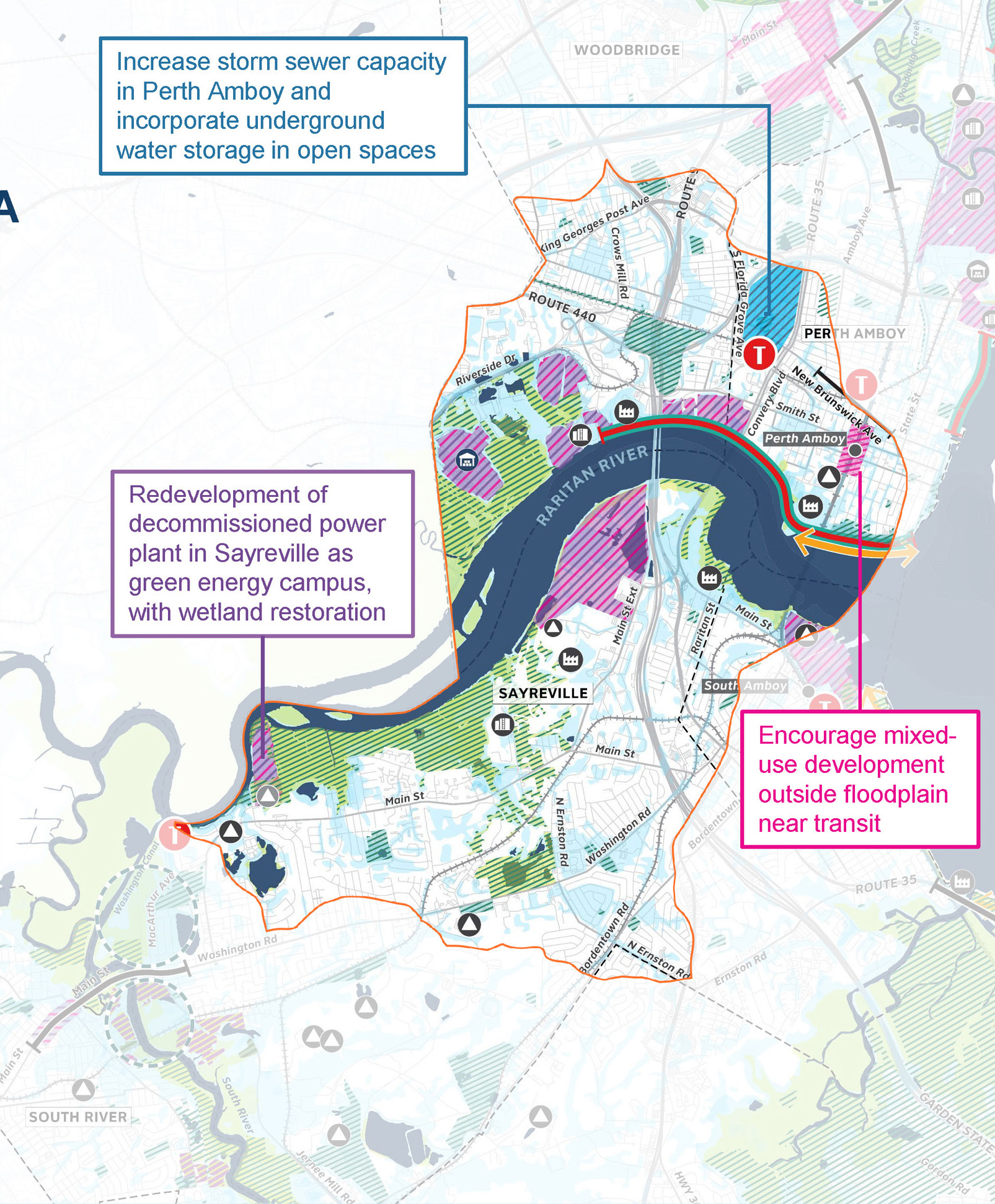
The protect scenario for Raritan River and Bay uses layered strategies to increase stormwater management capacity in Perth Amboy, including retrofitting parks with underground storage, storm sewer improvements and berms along the Raritan River with multi-use walkways provide flood defense and enhanced access. The restore scenario includes expanded use of public lands including right-of-way storage along a now inactive rail easement, beach replenishment along the Coast and wetland restoration along Raritan River. The transition scenario contains actions from previous two scenarios, including increasing storm sewer capacity and shoreline protection to ensure existing population and job centers like Perth Amboy can grow and thrive. It also proposes resilient redevelopment of industrial areas and mixed use development near transit outside flood- prone areas.
South River and Washington Canal FOCUS AREA
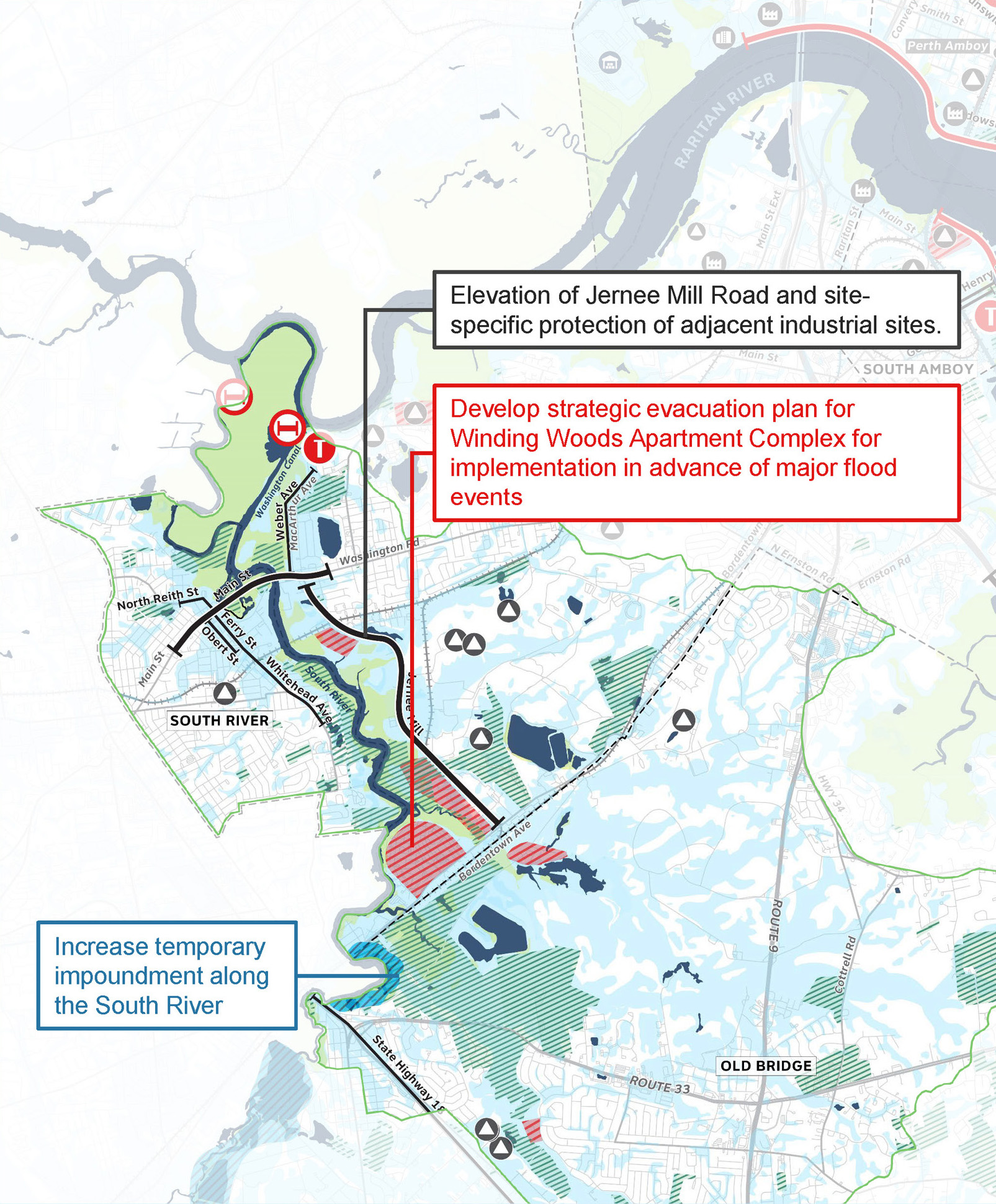
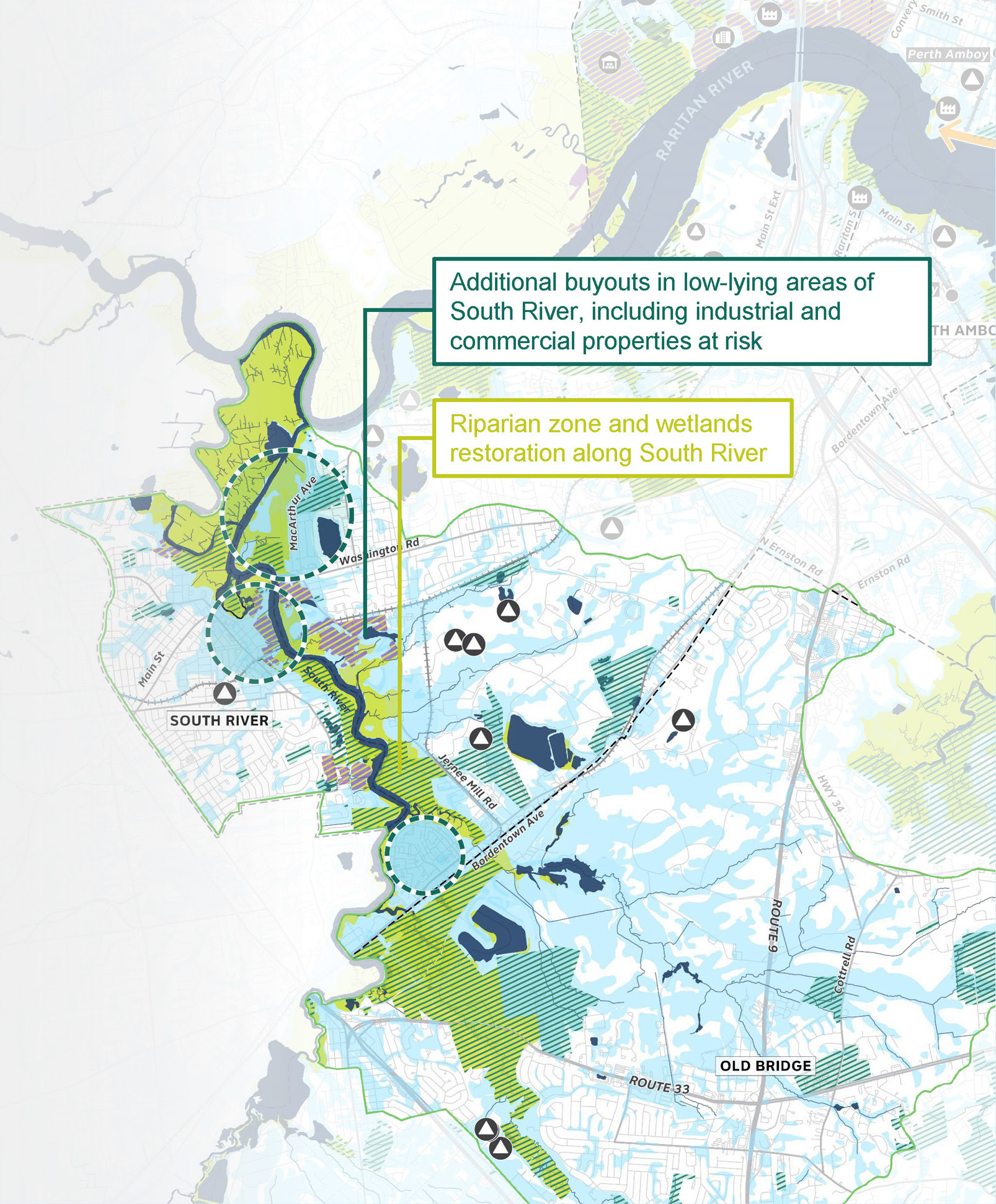
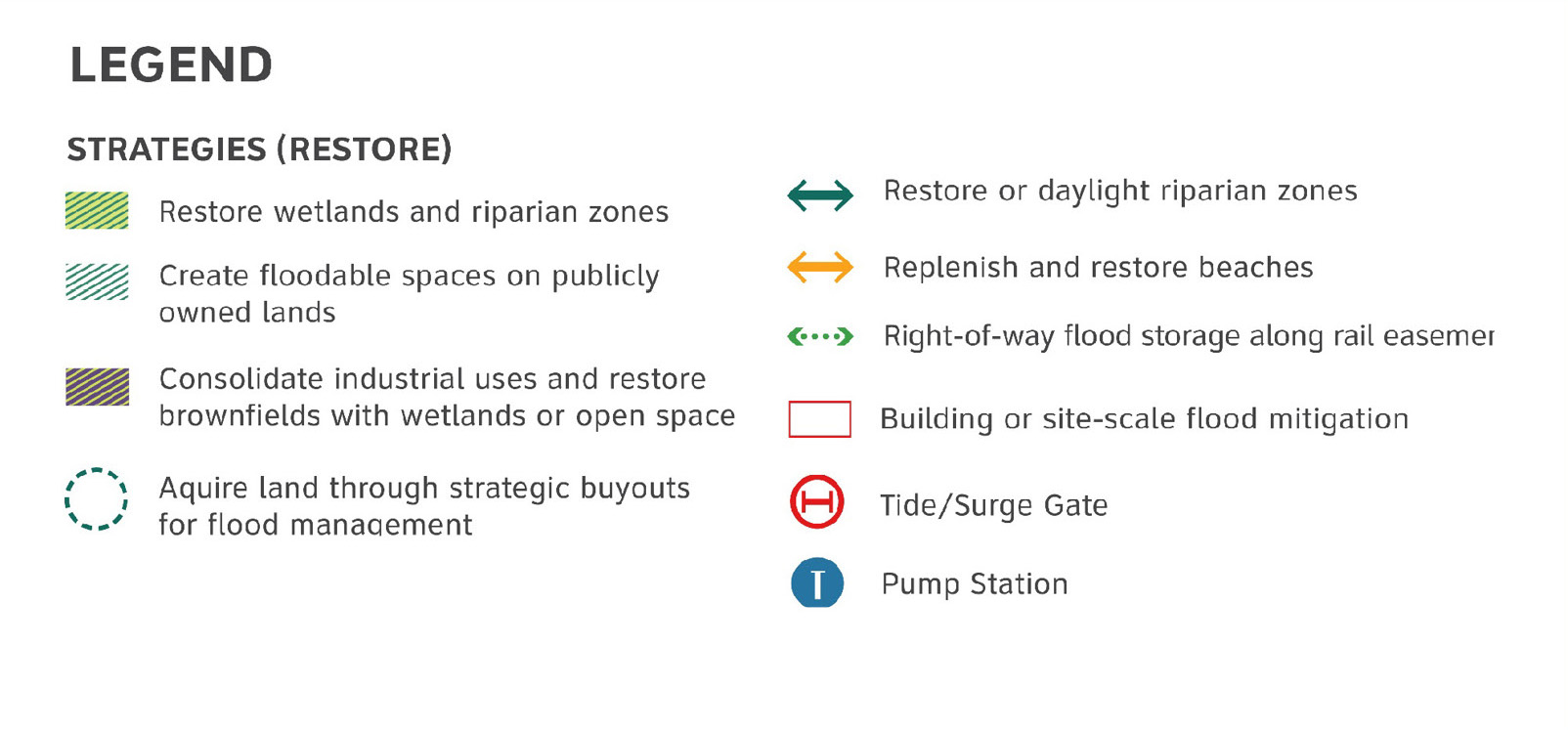
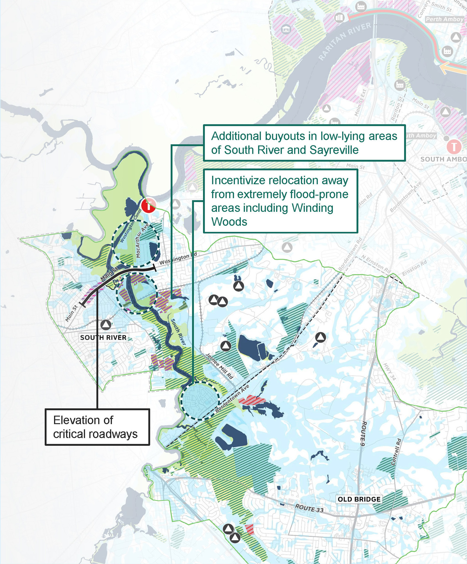
The protect scenario for South River and Washington Canal uses layered strategies to increase stormwater management capacity in Perth Amboy, including retrofitting parks with underground storage, storm sewer improvements and berms along the Raritan River with multi-use walkways provide flood defense and enhanced access. In South River watershed, with its complex flood regime, the restore scenario emphasizes riparian and wetland restoration enabled through additional acquisition of vulnerable properties, coupled with increased flood storage on public land in upland areas to further manage stormwater flooding. The transition scenario similarly emphasized acquisition of vulnerable properties through expansion of buyout programs and transitioning industrial sites for restoration and flood storage, avoiding the need for more structural measures like a tide barrier. This is coupled with site and building level adaptation in addition to elevation of critical roadways to ensure the area stays well connected and is able to thrive.
OLD BRIDGE FOCUS AREA
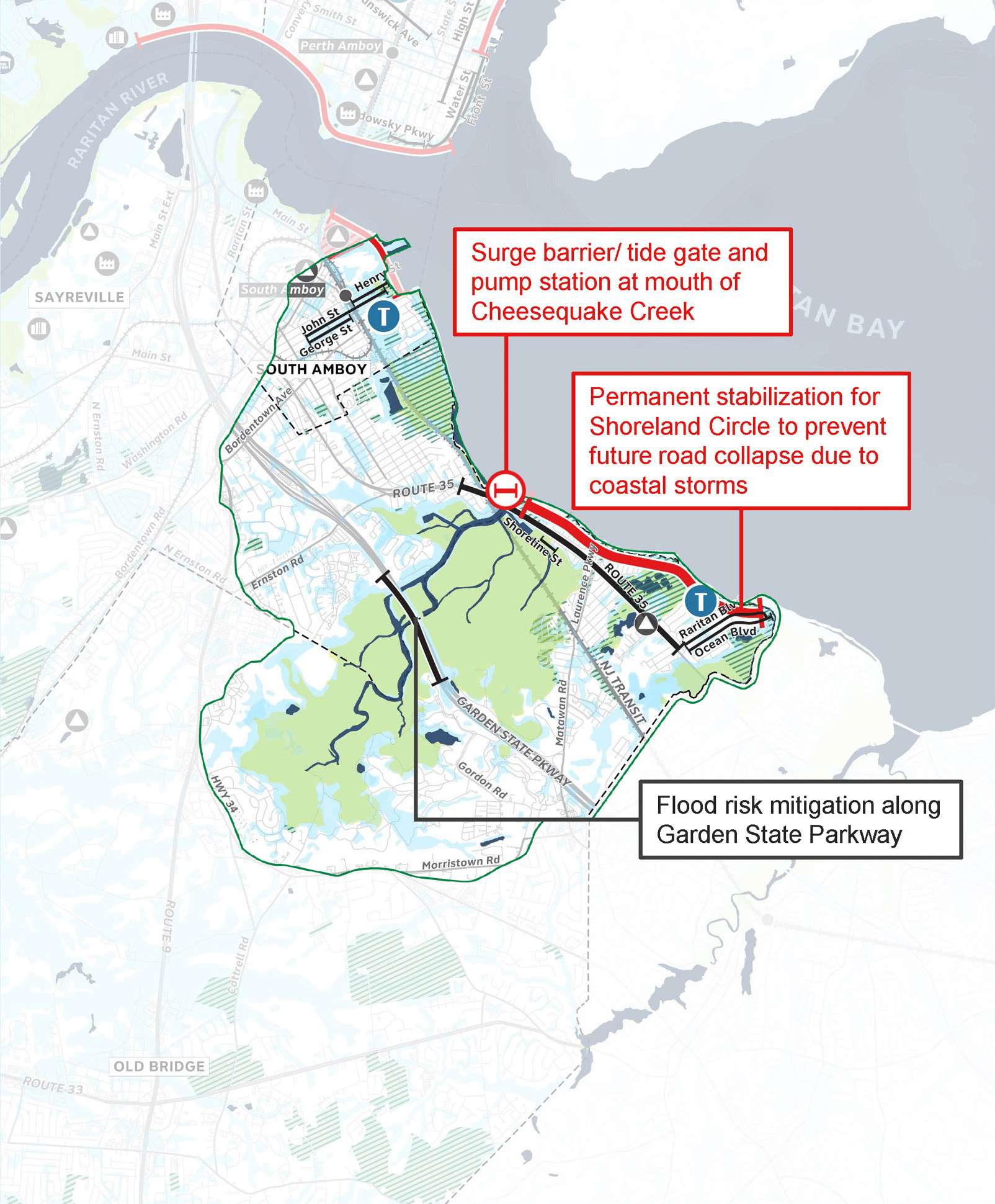
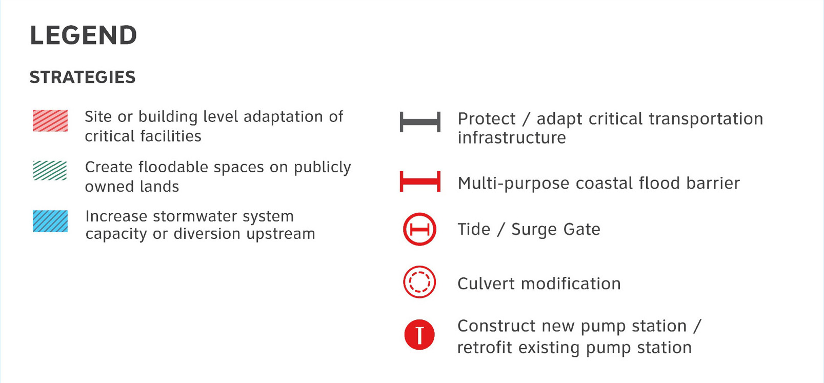
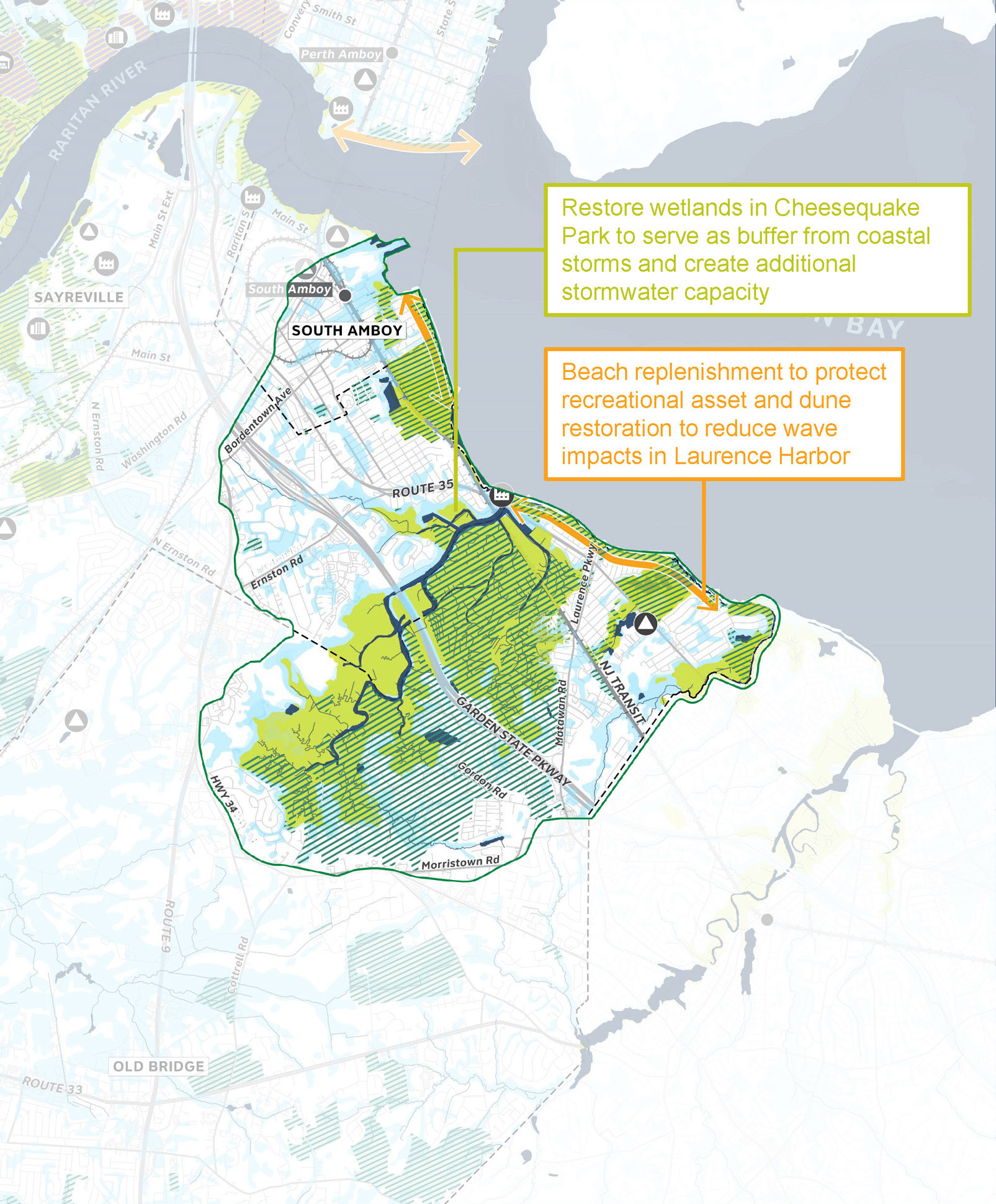
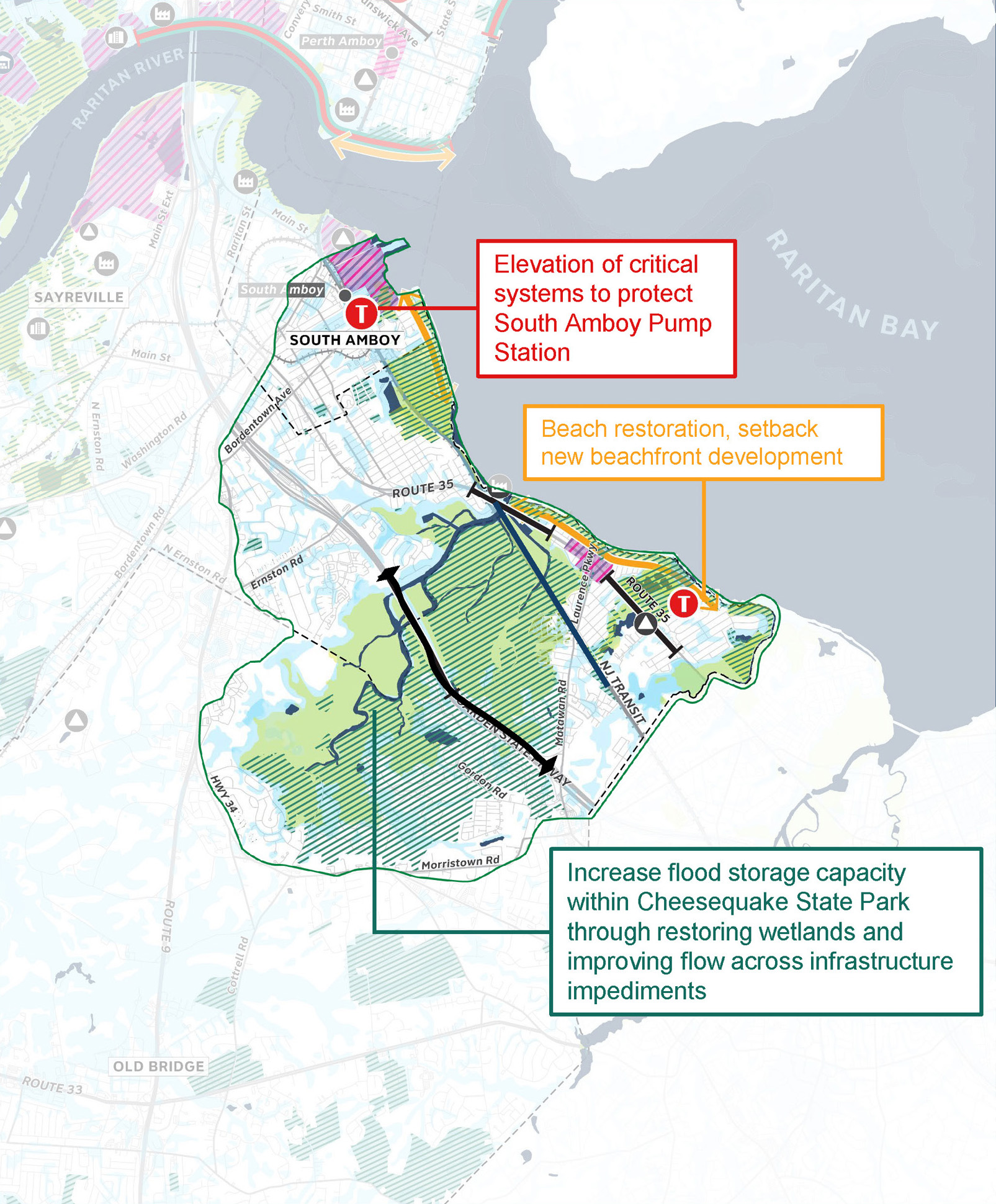
The protect scenario proposes surge barriers with a pump station at Cheesequake Creek inlet, coupled with shoreline stabilization along Raritan Bay beachfront combine to protect the shoreline from erosion and prevent inland flooding, and future damage to neighborhoods and transportation infrastructure. The restore scenario emphasizes nature- based strategies over hardened infrastructural solutions, including beach replenishment and dune restoration along Laurence Harbor, restoration of wetlands in Cheesequake Park to serve as buffer from coastal storms and create additional stormwater capacity, coupled with codes and funding programs to support building level adaptation in areas at risk. The transition scenario emphasizes the protection and resilience of key transportation corridors (including Route 35, Garden State Parkways and the NJ Transit and the management of flooding through natural systems within Cheesequake Park rather than grey infrastructure like tide gates, likely resulting a greater need to be complemented with some degree of building level adaptation around the state park.
Get Involved
Your input and involvement are critical to increasing the resilience of our communities. Opportunities to engage with the program will be updated periodically on the Get Involved page.
GET RESILIENT NJ PROJECT UPDATES!
You can easily stay in the loop with program progress by signing up for periodic email updates via this form.
EXPLORE OUR RESOURCE LIBRARY
The Resource Library contains our project reports, engagement materials, and other information about progress.

